Golf Cart Town Maps and Local Street Rules
Dedicated golf cart path maps for cart-friendly towns
Accurate, community-led cart maps
Golf Cart Towns combines OpenStreetMap-based path data, official local sources and information on local services
Popular Golf Cart-Friendly Towns in the United States
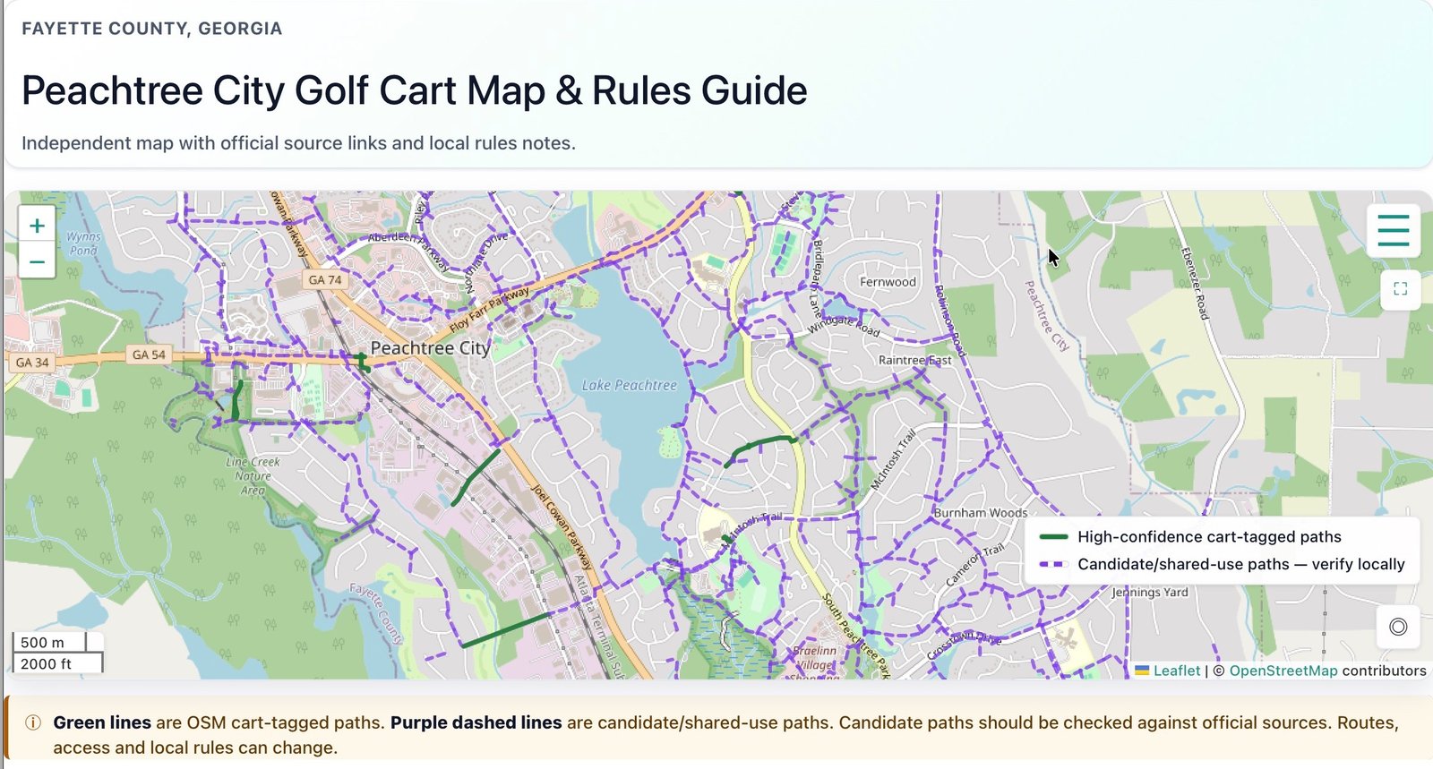
Inspired by the golf carts of Discovery Bay in Hong Kong where there are no cars, I am starting with towns in the United States where golf carts are now also part of everyday life. Peachtree City below is my first.
More Golf Cart Towns Coming Soon
The Villages, Florida
Probably one of America’s best-known golf cart communities, where carts are widely used for everyday trips.
Bald Head Island, North Carolina
A coastal island where golf carts and bikes are a normal part of getting around, especially for visitors arriving by ferry.
Sun City, Arizona
An iconic retirement community where golf carts were planned to be part of local life from the very beginning in 1960.
North Myrtle Beach, South Carolina
Drive your golf cart by the Sea!
Frequently asked questions
What is a golf cart town?
A golf cart town is a town or community where golf carts are commonly used for short local trips. Some towns have dedicated cart paths, while others allow golf carts on certain local roads.
What are the best golf cart towns in the United States?
Some of the best-known golf cart towns include Peachtree City in Georgia, The Villages in Florida, Sun City in Arizona, and Bald Head Island in North Carolina.
Where can I find golf cart path maps?
Some towns may publish official golf cart or shared-use path maps.
At GolfCartTowns.com, we plan to build over 20 maps by the end of 2026 to help you choose if you are planning a golf-cart-friendly vacation, looking for rentals, or considering relocating.
Are golf carts street legal?
Golf cart rules vary by state, county, city, and community. Some places allow golf carts on certain low-speed roads, while others only allow them on private roads or dedicated paths. Always check local rules before using a golf cart on public streets. We will include official source links to each town where possible.
What is the difference between a golf cart and an LSV?
A golf cart is usually designed for short-distance use at lower speeds. An LSV, or low-speed vehicle, can look identical to a golf cart but is a federally regulated, road-legal vehicle category that has headlights, taillights, mirrors, seat belts, registration, and insurance with a top speed of between 20 and 25 mph. The exact rules will depend on the state and local area.
Do I need a driver's license to use a golf cart?
In many public areas, yes. Some towns, such as Peachtree, require registration or a permit . Costs for these permits can rise for nonresidents. Private communities may have their own rules.
How accurate are the maps on GolfCartTowns.com?
Our maps are independent guides based on OpenStreetMap data. They are useful for planning, but they should not be treated as legal or navigation advice. Always follow local signs and official rules.
Why does a town page show fewer cart-tagged miles than the town’s official path network?
This can happen when OpenStreetMap does not yet label every official path as golf-cart accessible. A town may have a large official path network, but only some of those paths may be clearly tagged for golf cart use in map data.
What makes a town “cart-friendly”?
A cart-friendly town usually has clear local rules, safe low-speed routes, dedicated paths or shared-use trails, cart parking, good connections between neighborhoods and local services, and a culture of everyday cart use.